
Streets of London – Regent Street circa 1822
Regent Street, London circa 1822
from The Repository of arts, literature, commerce, manufactures, fashions and politics
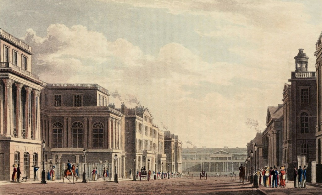
“The annexed engraving is a view of Regent-street, taken from a spot near to the establishment of the Horticultural Society, looking onward through Waterloo-place to Carlton-House, in Pall-Mall, and which faces the end of the street. Waterloo-place occupies the lower ground in front of this building, forming a square area, in the centre of which some work of ancient or modern art is proposed to be erected. The transverse opening is Charles-street, at the nearest corner of which is seen the United Service Club-House to the east, and Warren’s Hotel to the westward; on the latter side are several private buildings, and also Waterloo chapel, designed by Mr. Repton, the portico and turret of which are seen towards the front of the picture.” The Repository of arts, literature, commerce, manufactures, fashions and politics, 1822.
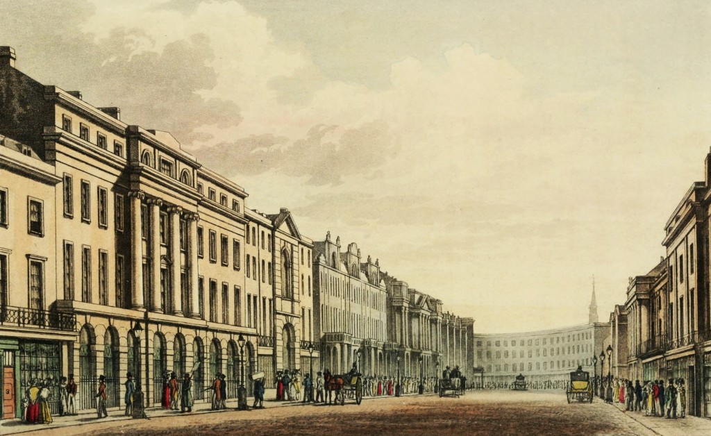
Regent Street from Waterloo Place – View circa 1822
from The Repository of arts, literature, commerce, manufactures, fashions and politics
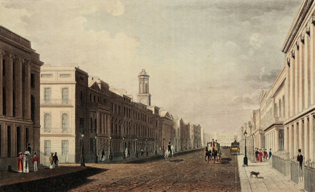
“The annexed view is taken from a point near to Charles-street, and looking northward. […] At Charles-street […] is Warren’s Hotel; Messrs. Hopkinsons’, the bankers, ranges of private residences, Waterloo Chapel, the Horticultural Society Establishment, and other buildings, are in the perspective. On the [right] of the picture are the United Service Club-House, various residences and offices for businesses, the houses of Mr. Nash and Mr. Edwards, with private dwellings proceeding onward to the Circus at Piccadilly, and to the termination of the view by the County Fire-Office, at which spot the Quadrant commences, and leads to the north division of the street.” The Repository of arts, literature, commerce, manufactures, fashions and politics, 1822.
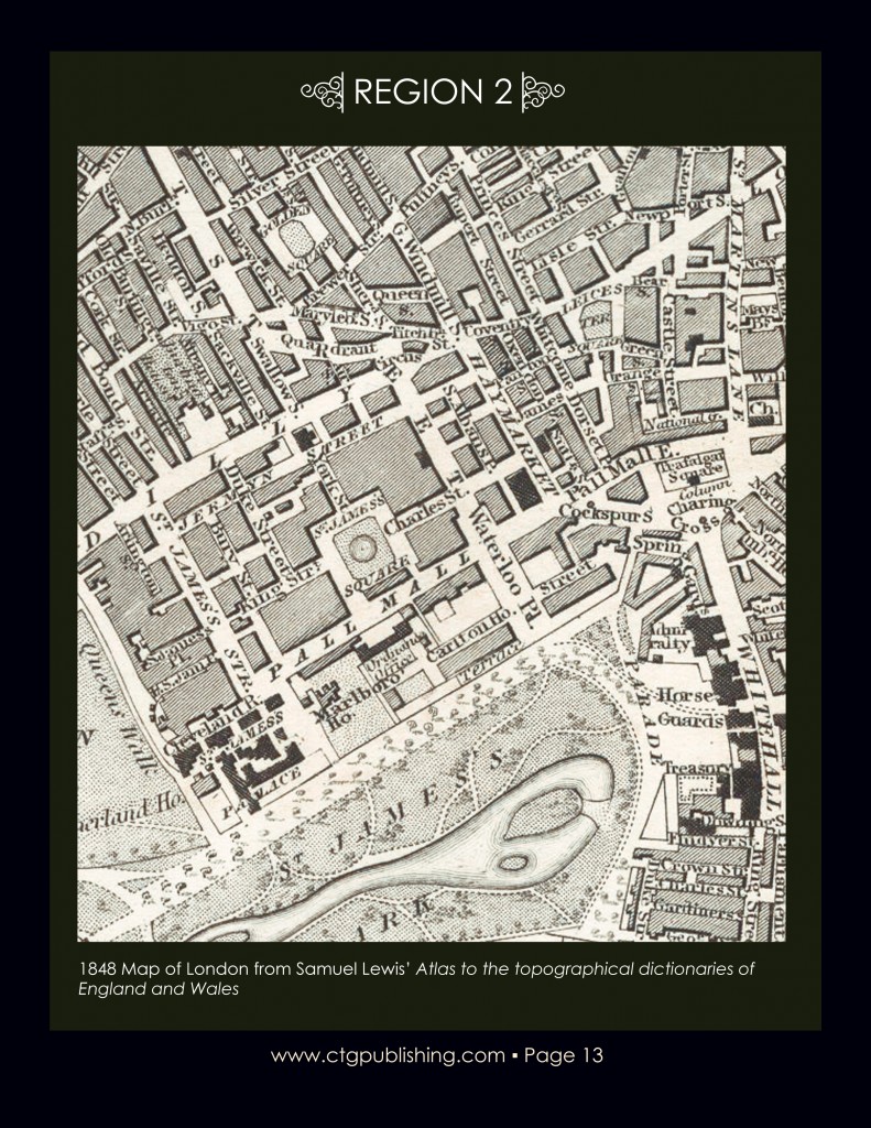
Map Waterloo Place circa 1848
from Map of London from Samuel Lewis’ Atlas to the topographical dictionaries of England and Wales
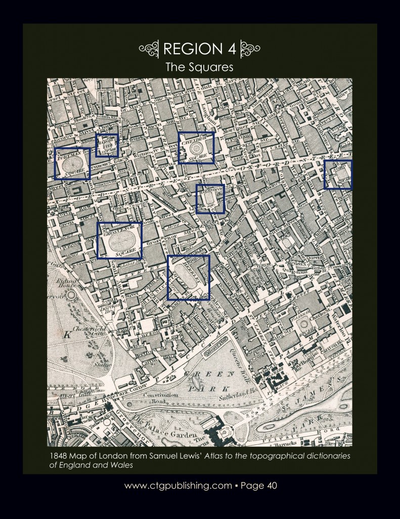
London Squares – Map circa 1848
from Map of London from Samuel Lewis’ Atlas to the topographical dictionaries of England and Wales
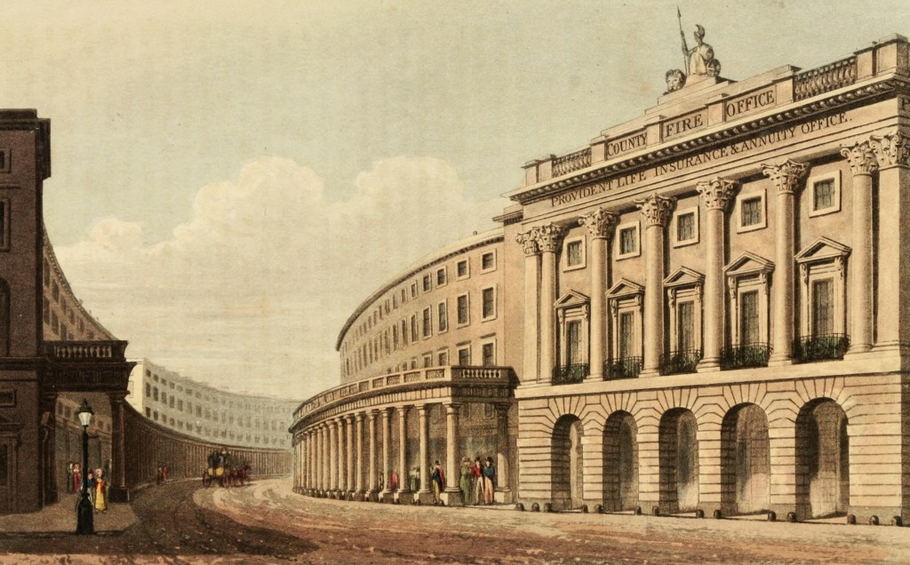
Regent Street Looking Toward Quadrant, London circa 1822
from The Repository of arts, literature, commerce, manufactures, fashions and politics
Regent Street Looking Toward Quadrant, London circa 1822
from The Repository of arts, literature, commerce, manufactures, fashions and politics